|
[index] [features] [download] [installation] [registration] [example 1] [example 2] |
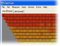 Geotest = geoelectrical data acquisition software
GeoTest is a software for controlling geoelectric equipment in combination with many electrodes. This type of geoelectric measurement is called Multielectrode Geoelectrics. Using two-dimensional or three-dimensional inversion techniques additionally for evaluation, this method is known as ERT = Electrical Resistivity Tomography or Geoelectric Tomography.
GeoTest runs on desktop or notebook PCs with Windows operating systems. The hardware specifications are not critical. Depending on the kind of geoelectrical equipment, specific interfaces (RS232, USB) are needed.
Hardware
GeoTest supports hardware manufactured by SchwaRTech (formerly LGM - Lippmann Geophysical Equipment:)![]()
- 4-point light hp / 4-point light 10W: a high power, low cost induced polarization earth resistivity meter in a small package: for Schlumberger soundings up to L/2 = 1 km; for mapping, monitoring, ERT = Electrical Resistivity Tomography, geoelectric tomography, lab work, induced polarization measurements, archeology
- ActEle: active electrodes for electrical resistivity tomography with a direct interface for 4point light hp / 10W. Available as cables for field work or as MUX (multi electrode boxes) for laboratory work.
- Supports by default up to 255 electrodes for profiling lengths up to appr. 1000 m.
- Special ActEle hardware with 2 byte address codes is available on request, which supports up to 65535 electrodes.
Interpretation of data
 We recommend the inversion software Res2DInv and Res3DInv for interpretation of geoelectric tomography measurements. Available by Schwartech.
- Res2DInv supports 2-dimensional depth sections with topography.
- Res3DInv supports 3-dimensional investigations with topography.
- ERT and IP data, in other words resistivity and phase angles.
- Supports on land, underwater and cross-borehole surveys
- Supports all possible arrays, like Wenner (alpha,beta,gamma), Wenner-Schlumberger, pole-pole, pole-dipole, inline dipole-dipole, equatorial dipole-dipole, MGA, FRG and non-conventional arrays.
- Processing filters and full manual tools.
- Supports smooth and sharp contrasts inversions
- Possibility to incorporate known information like borehole data.
- Easy visualization of pseudo sections, model sections, model grids or model blocks.
- Data import and export options.
- Compatible with Aarhus workbench Essentials
Software and licence policy
- 1 licence = 1500 EUR.
This fee includes the licence for using Geotest in combination with one geoelectric measurement device.
The user may install Geotest on up to 4 computers without an additional charge.
Any future updates of Geotest will be available without additional charges by download from our website. - 1 additional licence = 750 EUR
This fee is for the 2nd or following geoelectric measurement devices. Each geoelectrical device needs an own Geotest licence. Example: if the user has 2 geoelectrical devices, he also needs 2 Geotest licences:
1 standard licence and 1 additional licence. - Each Geotest licence has to be registered and activated. This is done by the user himself on the activation page:
activation.schwartech.de.
We can offer interesting packages:
Complete package for state-of-the-art ERT Geoelectrical Tomography consting of:
- measurement hardware: 4-point light 10W
- Active electrodes ActEle: up to 255 electrodes,
special hardware available on request with up to 65535 electrodes - measurement software GeoTest
- Inversion software ResXDInv
Interested? Please ask us.